Big Bend Birding / Hiking Trip Summary & Photos
Aug 11th-14th '06
 Once again friends and I were back in Big Bend for some birding and plenty of hiking! We had no target species of birds to find which takes the pressure off any trip to be able to enjoy everything else around, taking whatever shows up. We also wanted to do this trip during August, after the rains had arrived, which encourages flowers to bloom on shrubs and turns many of the dry pour-offs into trickling falls. The desert comes to life at this time of the year with cooling storms blowing through, bringing instant relief against the intense heat of the day. The mountains in the evening actually got quite cold as far as I was concerned! (we're talking low 50's here... brrrr!), with day time temps around 80º-85º in the mountains, 90º in the basin & 100º or more in the desert. Once again friends and I were back in Big Bend for some birding and plenty of hiking! We had no target species of birds to find which takes the pressure off any trip to be able to enjoy everything else around, taking whatever shows up. We also wanted to do this trip during August, after the rains had arrived, which encourages flowers to bloom on shrubs and turns many of the dry pour-offs into trickling falls. The desert comes to life at this time of the year with cooling storms blowing through, bringing instant relief against the intense heat of the day. The mountains in the evening actually got quite cold as far as I was concerned! (we're talking low 50's here... brrrr!), with day time temps around 80º-85º in the mountains, 90º in the basin & 100º or more in the desert.
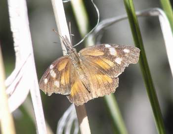
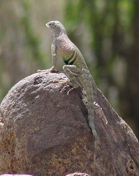
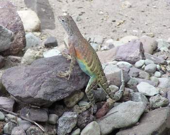
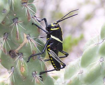
Always on the lookout for any wildlife we had several species of lizard, snakes and butterflies, although no Mountain Lions or Black Bear showed themselves on this trip, despite the cans of tuna and jars of honey we put out (kidding)!.
Day 1 - We arrived at midnight and by 4 am were on the trail up the pinnacles toward Boot Spring. Needless to say, starting out this early after driving all night with no sleep WAS crazy, even if I do say so myself! But, upward we climbed in good spirits, until that is I realized my sleeping pad had come loose from my pack without my knowledge! I was so mad & wasn't going to go half way back down to find it! Looks like I was going to have a slightly harder bed the first night than I had planned! Upwards we continued with our packs on our backs listening for owls. Western Screech Owls called out along with Whip-poor-wills. We made it up to the top before sunrise so had the hardest part of the trail completed before the sun added its heat.
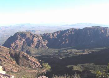
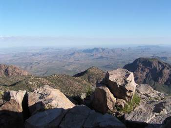
Before going on to Boot Canyon a couple of us headed up to Mt Emory, the highest peak in Big Bend. We dumped our packs and started climbing. We stopped at one point for a rest and a Colima Warbler flew into the tree about 6 foot above our heads! It was the only one we saw the whole trip. After about 45 mins to an hour & plenty of rock scrambling we reached the top and were rewarded by its 360º views! After resting for a while we made our way back down and continued along to Boot Spring.
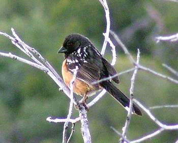
Close to the spring a couple of Mexican jays were fighting and were so tangled up together and within the shrubs, that they could not free themselves. I climbed into the scrub and was able to pull both squawking birds out. They had their feet clasped together so tight it took a few minutes to loosen their grips. The one birds head was totally raw as though he'd had all its feathers plucked out and was in bad shape. It was also banded with two color bands, which I also informed HQ about. From their records they were able to find that this individual bird was around 9-10 years old! We released the birds. one flew off but the banded one I placed into a quiet spot off the trail. I don't know if he made it or not but he did not look good. Beautiful birds....
Other birds around the spring area included several Painted Redstarts, Canyon Towhee, Wilson's Warbler & Blue-throated Hummingbird.
While resting at Boot Spring we looked up at some other hikers coming our way. Just on the off chance I asked them - "Did you come up the Pinnacles Trail? Did you happen to see a small, rolled up, grey sleeping pad by any chance"? I was shocked to see him turn around and point to his pack "This one"? LOL! He'd picked it up! What were the chances? I had my sleeping pad & I was THRILLED, not to mention very grateful!
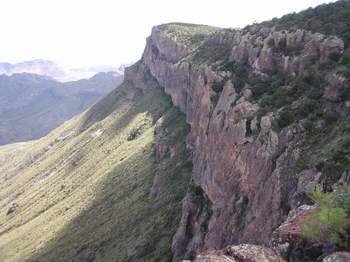
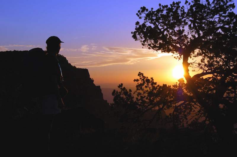
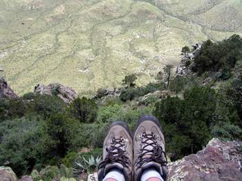
With my new found sleeping pad securely attached to my pack, we made our way along the 1.9 mile trail to the South Rim. It was a hot afternoon but it was nice to see the creek filled with water for a change and almost looked tempting to dip if we didnt know better! On finally reaching the rim, our legs tired and our bodies now feeling the exhaustion from the sleepless drive we sat & enjoyed the views. From the start of the trail it is 6.3 miles to the Rim, not counting Mt Emory with about a 2,500 foot climb in altitude. We reluctantly got up and made our way to our camp site about half a mile further along the SE Rim trail, put up our tents and crashed for an hour or so! Other than cooking our dinner, watching the deer walk around our tents and taking a short walk along the rim at sunset, where we found a peregrine sitting on a nest well below us, we had an early night. I was very thankful for my sleeping pad but it did get cold up there, around 52º. Total Miles Hiked - 9 Miles.
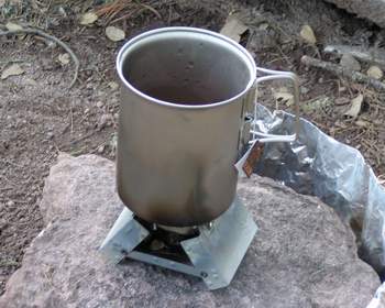
Day 2 - The next morning, after our cappuchino coffee (serious!), we packed up & headed to the rim to watch the sunrise. It was awesome! Birds were singing their dawn chorus, which is one of the reasons we wanted to camp overnight up here. We ate our cereal bars in silence, taking it all in.
We hiked back down the Laguna Meadow trail and it just felt like the longest hike! Still, better going down this way than up it! We got back down by noon where we immediately proceeded to the store for our usual ice cream!
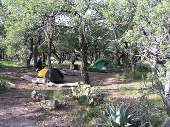
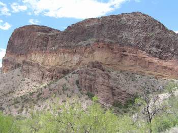
Our first stop for the afternoon was Burro Mesa Pouroff. Some cool rock formations led into the dry pouroff. There were plenty of colorful Lizards as well as Gray Vireo, Canyon Wren and Black-throated Sparrows. We spent about 30 mins here then went to the Homer Wilson Blue Creek Ranch just down the road, picking up Scaled Quail which was calling loudly, Cactus wren and Pyrrhuloxia. Finally it was on to the Rio Grand Village, seeing Vermillion Flycatcher, Lark Sparrow, Inca Dove, Cardinal, Golden-fronted woodpecker and Road Runner before heading for the showers. We were looking forward to a good meal and some wine at the Basin Lodge before crashing once again in our newly located campsite in the basin campground. It was another long day but a good one. Total Miles for the day - 10.5 miles.
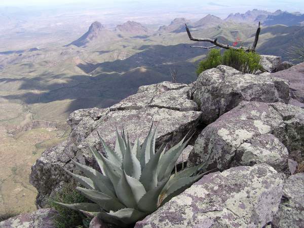
Day 3 - Our third day started off much better after having a better nights sleep & once we'd finished our cappuchinos set off for the 2.4 mile one way Lost Mine Trail. This trail, undoubtedly, has become my favorite hike in Big Bend so far. With every turn the view just got better. Everywhere was so scenic and by starting out early in the morning we were able to get to the top and back before the sun moved over the mountains to heat it up. Blue Grosbeaks, Spotted & Canyon Towhee, Bewick's and Canyon Wrens, Rufous-crowned Sparrow, Olive Flycatcher and Bushtits were along the trail. We climbed steadily, skirting the base of Casa Grande Peak, walking on a variety of surfaces from gravelly soil to sheer rock & up several steps until finally we reached the saddle where amazing views of Juniper canyon opened up, including Toll Mountain, North East Rim and Mexico in the distance. Climbing futher bought more views. Steeper switchbacks led us through pinyon pine and juniper, stopping every now and then to look down onto the Chisos basin campground and our tiny tents, until finally reaching an open ridge where the trail ended. After this point we walked the easy open ridge to the end to see both Juniper Canyon and Pine Canyon with the Lost Mine Peak in the distance for which the trail is named. It was beautiful! We probably could have stayed here all day but there were other places to see so after a rest turned around and headed back down just as the sun was coming around the mountain!
Next we were going to hike into Pine Canyon which we had just seen from the top of the Lost Mine trail. Crossing the first part of an ancient collapsed volcano (called a caldera) the trail crossed grassland desert which is a little higher in altitude than the surrounding desert, making it a little bit cooler. After the first mile however the trail entered a shaded, wooded canyon. Birds such as Bell's Vireo, Mexican Jay, Band-tailed Pigeon, Varied Bunting and Loggerhead Shrike were along the tail and the usual Canyon Wren sang out loud once we entered the canyon. By this point the skies got very dark and it wasn't too long before thunder and lightning got closer and the bottom fell out! I have to say, being in a canyon during a lightening storm has AMAZING accoustics! Wow! We had just reached the dry falls as the rain really picked up and it wasn't long before water began to trickle over the edge. By the time the worst was over there was a nice stream of water flowing. We couldn't have timed it better! Mexican Jays were chattering away and it seemed as though all the birds were enjoying the rain. This was a pretty canyon with some rock scrambling and steep narrow trails. Coming out into the desert after the rain we couldn't help but notice how the Prickly Pear Cactus seemed so plump and green after the rain! Everything smelt amazing and the temperature had dropped to a very comfortable 80º. The total round trip of this trail is 4 miles but it seemed longer, probably because we were slowed down by the storm.
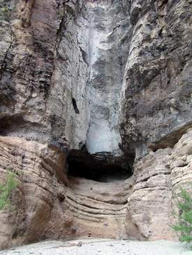
The last trail of the day was a short one, a one mile round trip to Ernst Tinaja. This was a hot, lowland desert hike at the base of the Dead Horse Mountain Range. The rock formations here though are what you come to see, along with the Tinaja itself which is Spanish for "Large earthen jar". This is a naturally formed basin-shaped water hole, carved by natural erosion & which holds water year round. This is an oasis for all wildlife from tiny insects, frogs, snakes and birds to the larger animals such as Mt Lion & Black Bear. When the water is low it may end up trapping animals that come to drink from it they are unable to get out due to its steep sides. We saw several frogs here, jumping in, but they knew just where they could get out. Along the trail leading to it there were bear tracks in the sand, but we did not come face to face with any on this day! The tilted & folded layers of the canyon walls were something else with colors ranging from white, gray, red & purple. Millions of years old with rocks originaly deposited on the ocean floor during the Cretaceous period I can not even begin to explain the geology of this area but can say its worth seeing! (And certainly reading up on if you're facinated with the Boquillas Formation).
The only birds seen here were Red-tailed Hawk, Loggerhead Shrike, Chihuahuan Raven and Turkey Vulture.
After returning to our camp site we cooked dinner instead of going to the restaurant. We were camping after all! We started out with appetizers of Salt 'n Vinegar Pringles and a rather nice 2004 bottle of red Shiraz served at a perfect 69º (Storms had blown through & lowered the temperature)! This was followed by a delicious lobster bisque filled with delicate crab meat and succulent shrimp. For our main course we had pasta with curried vegetables, which was very tasty and followed that with Cherry cobbler! Finished off the whole thing with Baileys Irish coffee.... now THATS roughing it!
Total Miles for the day - 12 Miles.
Day 4 - The last morning we hiked the Oak Spring Trail and Buttril Springs. Oak Spring we had done before but it was nice to see it in August as there were so many more plants flowering than I had seen previously. The home of Homer Wilson and his family once stood here and I have to say they lived in an awesome spot, even though the living was hard. We headed up the trail toward the window pour off and this is as far as we went, having done the upper part before. Canyon Towhee, White-winged Dove, Turkey vulture, Bell's vireo and Blue-gray Gnatcatcher were seen with the usual Canyon Wren against the walls surrounding the dry window pouroff. I couldn't help taking photo after photo of the different plants and cacti and the views are always nice. On the way out a Scaled Quail was calling while perched on top of a large rock. We headed back down and ate our freeze dried mint-chocolate-chip ice-cream we had left over from our stash of food. A food eaten by astronauts we thought we'd give it a try & after a few minutes without saying a word, agreed we were pleasantly surprised because it was pretty darn good for an ice cream that wasn't cold!
Buttrill Springs was next which was in the Rosillo Mtns to the west of us on the way out of the park. It was a long, dusty drive to the pull off area where we parked. About a 2 mile round trip hike the hot trail heads into a canyon where the Spring was flowing well, providing moisture to a variety of cottonwoods and willows. It is not a well used trail and still has remains of many pipes runing alongside the stream from the days when they tapped into the water source. We had much the same birds here as at Oak Spring and as the temperature was rising we called it a day, headed back to the car and began our 8 hour drive home. Total Miles for the morning - 5 miles.
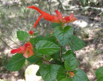
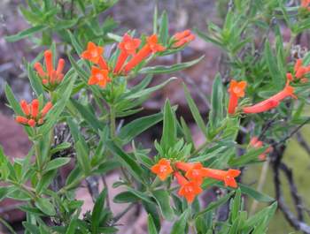
It was a great trip, with lots of new trails, new views and new plants, with the sight of Purple Ceniza (Texas Sage) in flower due to the rains! Total miles hiked for the trip - 42 Miles.
Enjoy the photos (Two pages) :-) |